
All Journal stories A History of Sark
The Sark JournalThe La Trobe brothers and their guide
Enjoying the Sark Journal? Get new Sark stories by email.
Between 1911 and 1913, Geoffrey and Leslie La Trobe Foster spent three summer holidays exploring Sark’s coast. Geoffrey was fifteen when they began; Leslie was around nineteen.
They followed gullies down towards the water, entered caves when the tide allowed, noted bathing places and recorded how one part of the coast connected to the next.
In 1914, they published Guide to the Coast, Caves and Bays of Sark.
The importance of the book is not simply that it described the island. It taught people how to read it.
A coastline that changes with the tide
Sark is around three and a half miles long and one and a half miles wide, but its coastline runs for around forty miles.
That apparent contradiction is part of what the brothers understood.
The island’s edge is folded into bays, caves, arches, stacks, gullies and pools. A place that appears close on a map may require a long descent. A cave that is open at one state of the tide may be unreachable later.
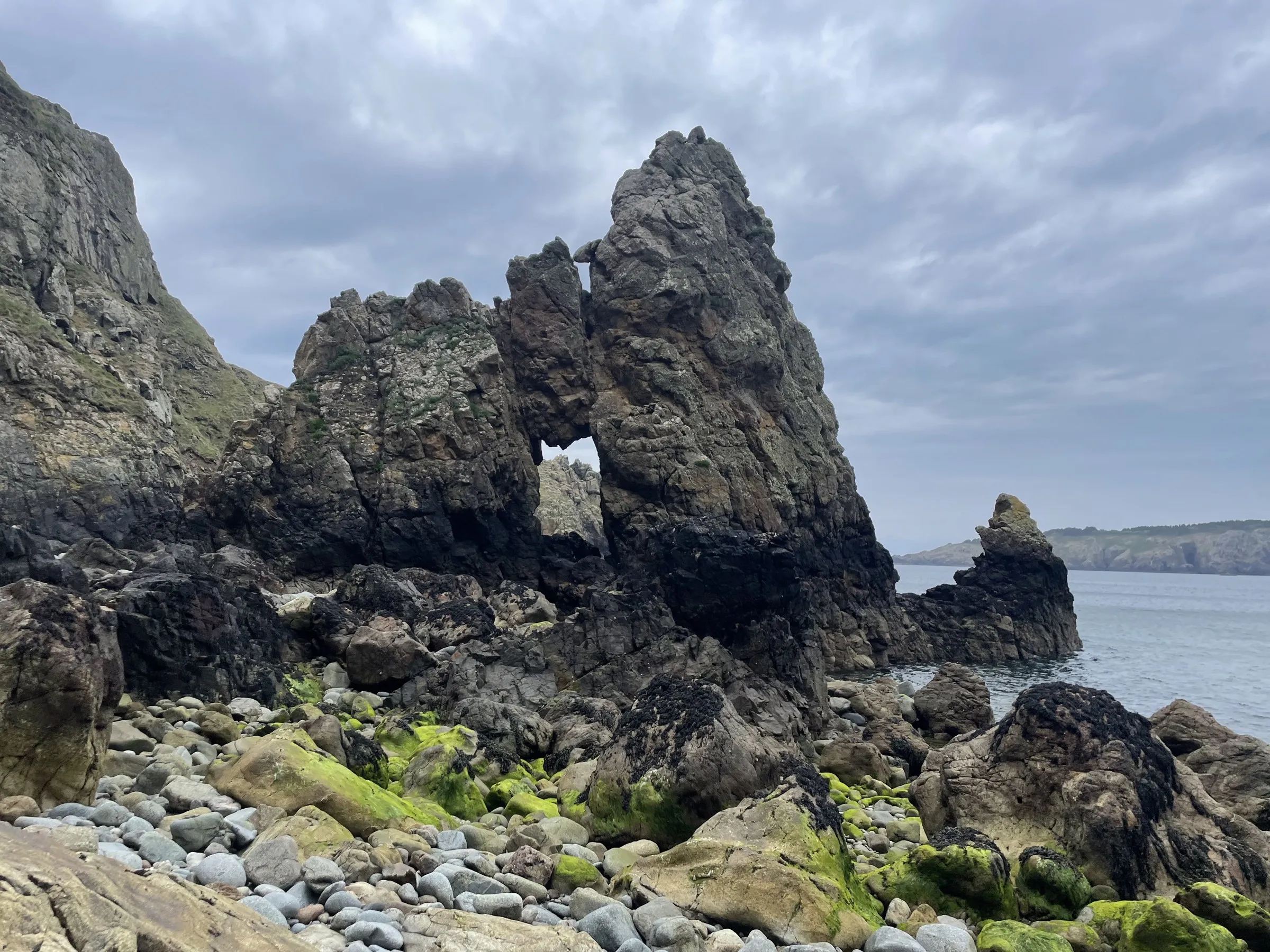
The La Trobes did not treat those details as decoration. They recorded them because the coast could not be understood without them.
Real places, named
The routes are not abstractions. They lead to named places, and the guide describes exactly what a visitor will find there.
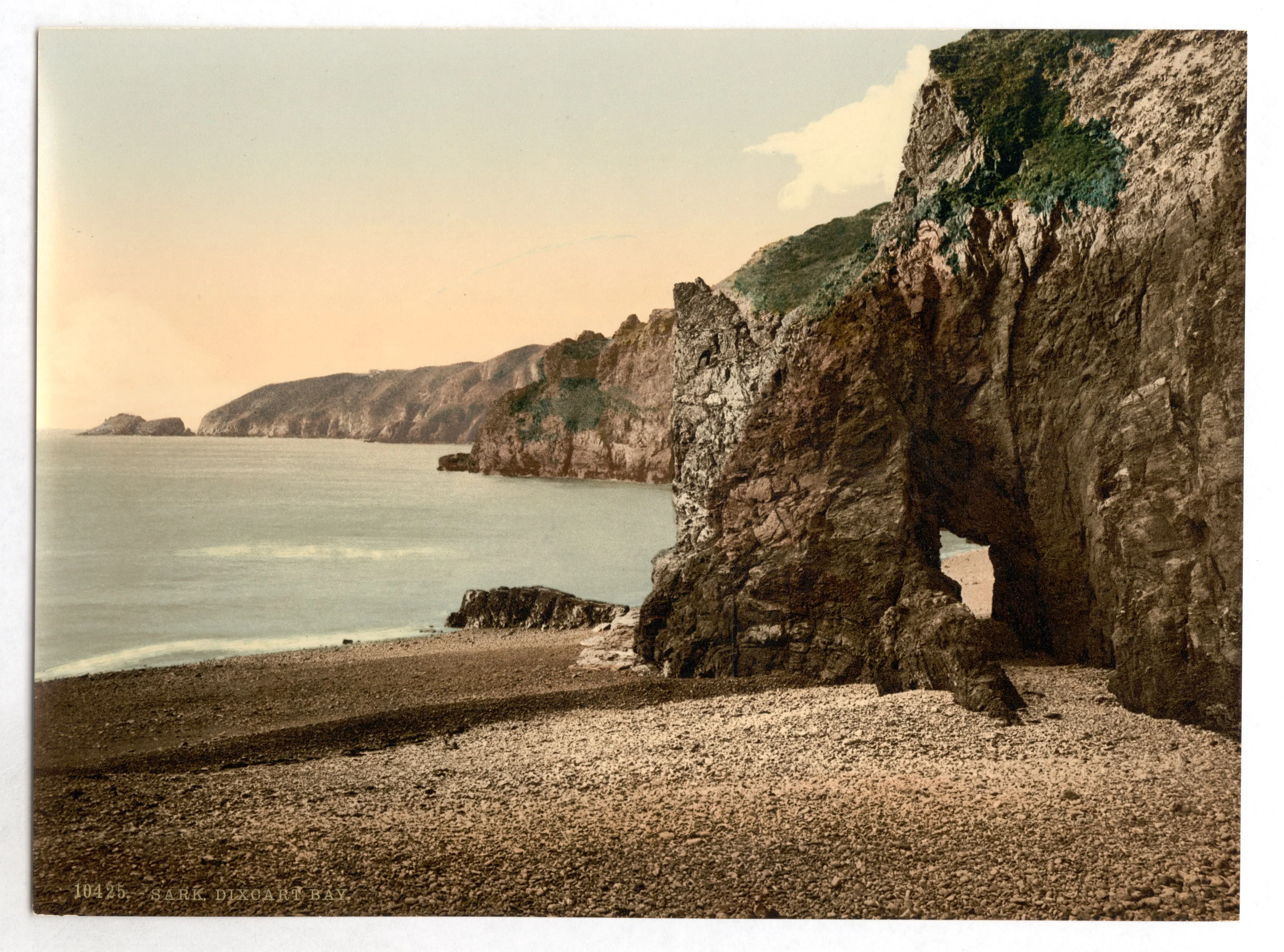
Route 8 leads to Dixcart Bay and its Natural Arch, one of the longest caves on the island at over a hundred and fifteen metres. The passage bends almost 180 degrees away from the light within its first stretch, so it stays dark for most of its length, and it holds three deep pools that the guide advises exploring with a good torch.
Route 13 leads to Adonis’ Pool, on the south east coast of Little Sark: a pool sixteen to eighteen feet deep, reachable only for about two hours either side of low tide. The guide’s own verdict, first given to Venus’ Pool and then repeated almost word for word for Adonis’, still stands: “no more delightful bathe can be imagined; it is the premier bathing place in Sark without a rival.”
Route 19 leads to the Mouton Cave, on the west coast, reached through a dark tunnel and a knee-deep pool into a dramatic, square-roofed chamber. It is open only for roughly half an hour either side of low water. The brothers had no reservations about it: “It is no exaggeration to say that as a single cave, it would be hard to find its equal in interest and splendour.”
These read as working notes, written by two young men who had made the scramble and the wade themselves, for the next visitor who would need to know exactly what to expect, not as decorative superlatives.
Their guide covered twenty-one coastal routes, with notes on access, tides, bathing and the shape of the ground. Most of them began at the same place: La Collinette, the crossroads where most of the island’s paths meet, from which the guide measured every distance and every timing that followed.
It made the island more legible without making it less mysterious.
They looked closely
The guide grew from repeated attention.
The brothers returned over three summers, walked the coast and built on an earlier survey, W B Woolnough’s Scrambles in Sark, published in 1861.
They were not writing a list of attractions.
They were trying to understand how the coast worked.
That meant noticing where a gully opened, where a route became dangerous, how long a tidal window lasted and what could be seen from one headland to the next.
Their achievement was not that they found a secret island nobody else knew.
It was that they paid enough attention to show how much one small island contained.
A book that survived its authors’ youth
The first edition appeared in 1914, the year the First World War began.
Leslie entered the Royal Marines that November. Geoffrey joined the Royal Fusiliers in 1916 and was wounded the following year. Both survived the war.
The editors of the current edition put the poignancy plainly. “The fact that both boys would have gone straight from publishing this account of their carefree exploration of their own idyllic island paradise, to the horrors of the First World War in the space of a few short months, lends this text an intense poignancy and which resonates still today, over a hundred years later.”
The book lasted because it remained useful, not because of that history.
The current eighth edition was published in 2014, one hundred years after the first, by a distant relative of the original authors and a regular visitor to the island. The guide had been out of print for more than twenty years before they brought it back. All twenty-one routes were walked again before publication, and every one of its profits still goes to the Professor Charles Saint Medical Trust, which helps islanders with the cost of their prescriptions.
The clearest sign of that continuity sits in the guide’s own last route. Route 21 takes the reader round the whole island by boat, a trip the La Trobe brothers first made in a rowing boat with two sturdy boatmen. The same circuit still runs today, in two and a half to three hours, past nearly every cave and headland the brothers named.
Its survival says something important about Sark.
The coastline is not fixed. Paths move. Landslips happen. Access changes. Tides remain unforgiving.
A guide to Sark’s edge has to be both historical and practical.
What the guide changes for a visitor
Without the guide, a headland may be a view.
With it, the same headland becomes the beginning of a route. A notch in the cliff becomes an entrance. A bay becomes a place whose shape, tide and history can be understood.
This shift is the La Trobe brothers’ real contribution.
Their real contribution was revealing that Sark’s smallness had been misleading, not enlarging the island itself.
The island contains more because they showed visitors where to look.
A guide built over three summers
The brothers returned for three summer holidays, followed gullies towards the water and entered caves when the tide allowed. A day is enough to cross Sark; their guide records what repeated visits allowed them to see.
The caves of Sark article explores the coastline the brothers recorded. Why a day isn’t enough explains why Sark opens differently when you stay.
