
All Journal stories Things to Do on Sark
The Sark JournalThe caves of Sark
Enjoying the Sark Journal? Get new Sark stories by email.
Most visitors first meet Sark from above.
They walk the lanes, look down from the cliffs and see bays folding into the coastline.
Go down into the caves, though, and a different island appears: what the sea has been doing beneath the paths, inside the headlands and below the line visible from land.
The coastline changes with the tide
Sark sits in an area of exceptional tidal movement.
The difference between high and low water can exceed ten metres on spring tides. A cave entrance visible in the morning may be underwater later. A route that appears open can close quickly as the sea returns.
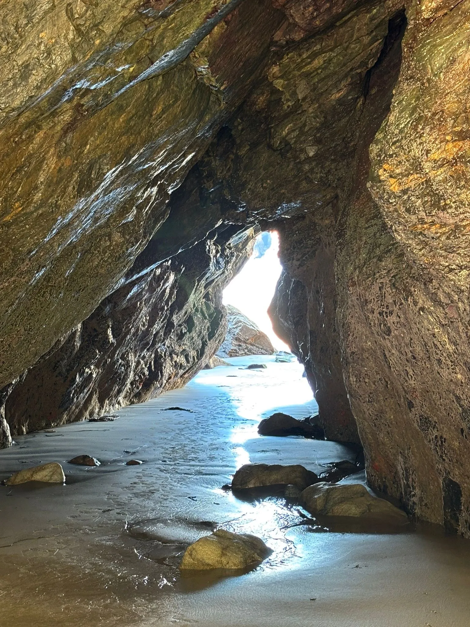
At low water, passages, pools and rock platforms emerge. At high water, many disappear completely. Visitors who walk down at low water can watch that difference for themselves.
Sark is around three and a half miles long and one and a half miles wide, but its edge is folded into bays, gullies, arches and caverns, which is why a small island can contain so much coastline.
The island is compact from above and intricate underneath.
The Gouliot Caves
The Gouliot Caves lie on Sark’s western coast, beside the narrow passage separating Sark from Brecqhou.
Water moves rapidly through that channel. The constant flow carries plankton and supports marine life that would usually be found in deeper water.
Inside the lower caves, rock surfaces are covered with anemones and other marine organisms that would usually be found much deeper, surviving here within the tidal zone because the passage is so strongly flushed by the sea. This ecological importance led to the Gouliot Caves and Headland being designated as a Ramsar site of international importance in April 2007. The species recorded inside them are catalogued in the island’s own marine life records.
Above the cave is a grassy headland. Below it is a marine environment governed by current, tide and darkness.
Only the lowest spring tides open the inner sections, and the safe window can be brief. They are not places to enter casually or alone.
The Boutiques
At Sark’s northern end, the Boutiques form another cave system beneath the cliffs near Bec du Nez.
Their name is commonly linked to their use as a store for contraband during Sark’s smuggling years. A dry inner area would have provided something rare along this coast: shelter above the reach of ordinary tides but hidden from view.
That history makes sense once the geography is understood.
From the land, the northern headland appears exposed. Inside the rock, chambers and passages created concealment, and the caves became working space within the island’s economy and its less official trade.
Today, reaching them involves tidal knowledge, scrambling and familiarity with the route. The detailed instructions belong in a current specialist guide, not in a general visitor article.
Sark’s cliffs contain spaces that cannot be read from the path above.
Why some caves make noise
Some caves are remembered because of the sounds and effects produced when sea and air are forced through them.
The Dog Cave, beneath Point Robert, is said to bark under particular combinations of wind, swell and tide. It runs about eighty yards into the cliff.
The Souffleur Cave can throw spray upwards during a south-westerly gale, when pressure inside its domed roof forces air and water back out through a narrow opening.
These are folk names for a real physical process: waves compress air inside confined spaces, and water is forced back out through smaller openings.
The cave associated with Victor Hugo
A cave on Sark’s western coast carries the name of Victor Hugo, who lived in exile on Guernsey and visited Sark.
Local accounts have long connected the cave with the octopus episode in Toilers of the Sea. The story is frequently repeated, but it should be treated as tradition rather than documented certainty.
The cave itself is real and difficult to reach. It cannot be entered on foot, and the surrounding water is dangerous. The La Trobe guide warns against attempting it without someone who knows the area.
For most visitors, it is a place to understand from the coast or see from a boat rather than an objective to enter.
Adventure is not improved by pretending risk is part of the romance.
What the caves change for a visitor
Many of the views visitors photograph on Sark are taken from high ground.
Visiting the caves shifts that attention downward, from the clifftop view to what lies beneath it.
Every headland has another side, every bay continues beneath the waterline, and every low tide briefly uncovers a version of the island that will not stay available.
That is why visitors who come back see more of the coast, not less.
The same place changes with tide, weather and light. What was inaccessible yesterday may open today. What was visible at noon may be gone by the afternoon.
Seeing the caves takes patience: visitors go when the tide is out, not whenever they like.
Seeing them safely
Some caves can be seen from established paths, from bays at suitable states of tide or from a boat.
Entering the more remote systems requires current tide information, suitable footwear, torches and local knowledge. Wind and atmospheric pressure can alter the height and timing of the water, so a printed route description is never a substitute for judgement on the day.
Guided kayaking or coasteering offers a safer way to understand sections of the coast that are difficult to reach independently.
Seeing a cave from outside loses nothing that matters: the tide opens and closes these caves on its own schedule, not the visitor’s.
The La Trobe brothers article explains the guide that first mapped these routes in detail. Walking Sark explores the paths above them. The Getting to Sark guide covers the journey to the island.
