
All Journal stories Nature on Sark
The Sark JournalThe Gouliot Caves, surveyed since 1885
Seven species found in every survey from 1885 to 2012
Enjoying the Sark Journal? Get new Sark stories by email.
On 8 April 2012, on one of the lowest tides of the year, five ecologists walked into a cave system on Sark and recorded 73 marine species. Their list joined a series of records reaching back to 1885, and the comparison suggested something remarkable for any wild habitat: the community in the innermost chamber had not significantly changed in 127 years.
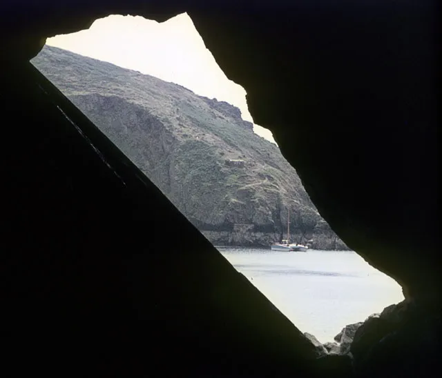
The Gouliot Caves pass through the Gouliot Headland, open to the sea on both sides and submerged by strongly surging water at high tide. The island’s then Seigneur, recorded as Mr Le Pelley, first discovered them in 1835.
Before the surveys
The scientific record begins in the Victorian period. The story of the caves begins earlier.
A later scientific report gave 1853, and that date found its way into some modern accounts of the caves. The Reverend James Cachemaille’s own nineteenth-century account places the discovery in 1835.
Within a few decades the Gouliot had become one of Sark’s celebrated sights.
Visitors did not come only for the scale of the caves. They came for what was living on the walls.
Henry Wentworth Acland, the Oxford physician and anatomist who later became Regius Professor of Medicine, brought his family to Sark specifically to see them. He arrived with a letter of introduction to the island’s vicar.
The sponge specialist James Scott Bowerbank went further. He visited Sark twice and spent about three weeks on the island in total, examining the caves and their marine life. Accounts of his work vary in their precise count, but he recorded around forty species of sponge.
He was one of the leading British authorities on sponges and later produced the Ray Society’s multi-volume Monograph of the British Spongiadae.
The Gouliot had become scientifically interesting because the caves put an unusually rich marine community within reach of people on foot, briefly.
Naturalists entered when the sea withdrew, worked against the clock and left before the water reclaimed the passages. That same constraint still governs access today.
Modern ecologists have been able to test how much of that community survived.
Inside the chambers
Surveyors enter down a boulder slope into the Sponge cave, where the light fades and the passage narrows, then reach the Jewel cave, where light streams in through an opening in the ceiling.
The Jewel cave takes its name from the jewel anemone, Corynactis viridis, which reproduces by stretching itself and splitting in the middle, one animal becoming two. That splitting is why the anemones appear in patches of matching colour across the walls.
The beadlet anemone, Actinia equina, adds a puzzle of its own. The caves are unusual in that every colour morph of the species, red, brown, green and orange, can be found here, and no scientific explanation for the variety has been established.
The 2012 survey
The 2012 fieldwork was carried out for La Société Sercquaise by five members of the Porcupine Marine Natural History Society, on the island during the Society’s Guernsey-based fieldtrip and guided by Sue Daly. The all-female team of ecologists called themselves the Gouliot Girls. Working one of the lowest tides of the year, they recorded 73 species.
Seven species, five surveys
Between 1885, when R. Koehler published the first survey, and 2012, five separate campaigns recorded 190 species in the caves. Only seven were found every single time: the boring sponge, the breadcrumb sponge, the elephant hide sponge, the beadlet anemone, dead men’s fingers, the jewel anemone and the oaten pipe hydroid.
The stronger finding sits underneath that list. The Jewel cave community recorded in 2012 matches a classified biotope, anemones, crustose sponges and colonial ascidians on very exposed or wave surged vertical infralittoral rock, and all five surveys are indicative of that same biotope. In the report’s careful language, this suggests no significant change in the Jewel cave since the first survey. The full 2012 species list is published on our marine records page.
Why the protection matters
The record could have read very differently. In his Descriptive Sketch of the Island of Sark, published in 1875, the Reverend James Cachemaille recorded that visitors had removed so much of what was of special interest that the cave walls were becoming bare, and much of their beauty and interest were being lost. That complaint came roughly forty years after the caves were discovered.
In 2007 the Gouliot Headland and Caves were designated Wetlands of International Importance under the Ramsar Convention, the only sea caves in the British Isles to receive that recognition.
When the caves can be reached
Access depends entirely on the tide. The tidal range around Sark reaches up to ten metres, with currents up to ten knots, and at high tide the chambers are submerged. The full system can only be reached on foot on a good spring tide, and the lowest tides of the year give the shortest safe access window. Divers have a constraint of their own: on the falling tide the current slackens for a few minutes at half tide, and outside slack water the currents make it impossible to stay in the caves for more than about 30 minutes.
If you visit, plan around the tide rather than around your day. On the right spring tide you can stand in the Jewel cave and look at a living community that the surveys suggest is recognisably the one listed in the first Victorian record. Check the tide times before you commit to the walk, take local advice on the island, and leave the walls exactly as you found them. Cachemaille described what happened the last time visitors did otherwise. The Getting to Sark guide covers the journey to the island.
